

Quick Facts
- Time Zone
- Pacific Time (UTC-8 / UTC-7 DST)
- Dialing Code
- +1
- Currency
- US Dollar (USD, $)
- Power Plug
- Type A, B (flat 2-pin, common across North America)
- Language
- English
- Emergency
- 911 (police, fire, ambulance)
- eSIMno Networks
- AT&T, Verizon Wireless
How to Get Your eSIM
- Pick Your Data Plan
Choose a USA eSIM that fits your Bay Area trip length — weekend getaway, week-long conference, or extended West Coast road trip. Plans cover San Francisco and every state you might visit after. - Install at Home Before You Fly
Download the eSIM profile over your home WiFi the night before departure. The whole process takes under 3 minutes on iPhone or Android — no physical card, no tools. - Keep Your Home SIM Active
Your phone's dual-SIM setup lets you receive calls and texts on your home number while eSIMno handles all data. No need to swap cards or miss messages from family. - Activate After Landing at SFO
Once the aircraft reaches the gate and you switch off airplane mode, your eSIM connects to AT&T or Verizon automatically. By the time you're walking toward BART or the rideshare pickup, Maps is already loading directions. - Stay Connected Citywide and Beyond
The same plan works from Fisherman's Wharf to the Castro, from SFO to Oakland Airport, and across every US destination on your itinerary — no reactivation, no extra fees.
Traveler Tips
- BART runs from SFO to downtown Powell Street Station in about 35 minutes — have the BART app loaded before landing so you can check real-time departures instead of staring at static schedules.
- Alcatraz ferries depart from Pier 33, and timed-entry tickets often sell out 2-3 weeks ahead. Book online and keep the QR confirmation accessible on your phone — cellular signal is solid on the pier and on the island itself.
- Uber and Lyft pickups at SFO use a designated lot on Level 5 of the parking garage. The apps need data to summon your ride and track arrival — airport WiFi can be sluggish during peak hours.
- Cable car lines at Powell and Market can stretch 45 minutes on weekends. The Muni app shows real-time car positions so you can time your arrival or catch the less-crowded California Street line instead.
- Fog rolls in fast through the Golden Gate, especially June through August. Check weather apps before heading to Ocean Beach or Lands End — conditions at Fisherman's Wharf and the Mission can be completely different.
Why Data Matters in San Francisco
San Francisco's geography makes real-time navigation essential. The city packs 49 square miles of steep hills, one-way streets, and transit options that change by the block. Walking from the Financial District to North Beach looks flat on a static map but involves a climb up Telegraph Hill that Google Maps' live elevation profile handles better than guesswork. Muni buses run 80+ routes with schedules that shift during Giants game days at Oracle Park — the Muni app's live departure boards beat waiting at a stop with no posted times.
Rideshare demand spikes around Moscone Center during tech conferences like RSA Conference 2026 and Dreamforce. Uber and Lyft surge pricing can triple within minutes; having data means you can check both apps simultaneously, walk a block to a lower-surge zone, or pivot to BART's Powell Street Station 8 minutes away on foot. The same applies after a late dinner in the Mission — the 16th Street BART station is a 12-minute walk, but only if you can confirm the last train hasn't already left.
Timed-entry attractions demand connectivity. Alcatraz Island tickets require a QR code scanned at Pier 33; the California Academy of Sciences uses mobile tickets for planetarium shows; Exploratorium reserves slots for the Tactile Dome online. Even casual stops like Ferry Building Marketplace reward spontaneity — the Cowgirl Creamery counter line moves faster if you've already pulled up the menu. An eSIMno plan for San Francisco keeps all of these apps running whether you're inside the Salesforce Transit Center or standing on the windy deck of an Alcatraz ferry.
About San Francisco & What Travelers Come For
Neighborhoods at a Glance
Fisherman's Wharf and Pier 39 anchor the tourist waterfront — sea lions, sourdough bread bowls, and ferry departures to Alcatraz. Union Square sits a cable car ride south, surrounded by flagship retail and theater marquees. The Mission District runs along 24th Street with murals, taquerias, and Dolores Park's hillside views. Chinatown crowds Grant Avenue with dim sum houses and herbal shops, while North Beach blends Italian cafés with City Lights Bookstore's Beat Generation history. The Castro flies rainbow flags above vintage streetcar stops, and the Haight-Ashbury intersection still draws tie-dye pilgrims.
Top Things Travelers Come For
The Golden Gate Bridge is the postcard shot — walk or bike the 1.7-mile span from the welcome center to Vista Point on the Marin side. Alcatraz Island draws over 1.4 million visitors annually for cell-block audio tours and panoramic bay views. The cable cars on Powell-Hyde and Powell-Mason lines are moving landmarks, climbing grades that buses can't handle. Golden Gate Park stretches 1,017 acres from the Haight to Ocean Beach, housing the de Young Museum and the California Academy of Sciences under one living roof. Chinatown's Dragon Gate marks the oldest Chinatown in North America, and Coit Tower's murals offer 360-degree city views from Telegraph Hill.
When to Visit
September and October deliver the warmest, clearest days — locals call it second summer. June through August bring fog that burns off by noon in the Mission but lingers at Ocean Beach until 3 PM. December through February see rain and fewer crowds at Alcatraz, though early booking still matters for weekend ferries.
Getting Around San Francisco
Airport Transfers
SFO sits 13 miles south of downtown. BART's yellow line runs directly from the international terminal to Powell Street Station in about 35 minutes; fares run around $9-10 one way. Uber and Lyft pickups are on Level 5 of the domestic parking garage — expect $35-50 to Union Square depending on traffic and surge. Oakland International Airport (OAK) serves budget carriers; BART connects OAK to downtown SF in roughly 50 minutes via the Coliseum transfer.
Public Transit
Muni operates buses, light rail (the N-Judah, K-Ingleside, L-Taraval, M-Ocean View, T-Third lines), historic streetcars along the F-Market route, and the three cable car lines. A single ride costs around $3.00; Clipper cards and contactless tap-to-pay work system-wide. BART handles longer hauls — Mission District, the East Bay, SFO, and OAK. Caltrain runs south to Palo Alto (35 minutes) and San Jose (60 minutes) from the 4th & King terminal.
Walking & Rideshare
Downtown, Chinatown, North Beach, and Fisherman's Wharf cluster within a 2-mile radius — walkable if you don't mind hills. The Embarcadero waterfront path is flat and scenic for biking or e-scooters (Bay Wheels docks every few blocks). Uber and Lyft are everywhere, but surge pricing spikes around Oracle Park on game nights and Moscone Center during conventions. Having data lets you compare apps and time your pickup.
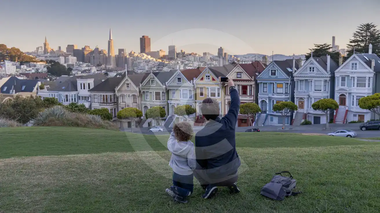
Painted Ladies & Alamo Square
Compare eSIM Providers in San Francisco, California
eSIMno | Local SIM / Operator | Roaming | |
|---|---|---|---|
| FEATURES | |||
| Setup time | Few minutes | Store kit, needs activation | Auto |
| No local ID needed | Online checkout | No SSN; passport at carrier stores | Use home account |
| Speed | 4G/LTE on AT&T, T-Mobile and Verizon; 5G in some areas | One carrier only | Partner-dependent |
| Travel support | English support 24/7 | English-language service | Home carrier hours |
| Keep home number | Dual SIM | Replaces it | Same number |
| Cost predictability | Fixed price | Advertised price needs Auto Pay | Bill-shock risk |