
Quick Facts
- Pedestrian Hours
- 5:00 AM – 6:30 PM (winter) / 9:00 PM (summer)
- Walk Distance
- 1.7 miles (2.7 km) one way
- Admission
- Free for pedestrians & cyclists
- Vehicle Toll
- $9.75 southbound (electronic only)
- Address
- Golden Gate Bridge, San Francisco, CA 94129
- Nearest Transit
- Muni Bus 28 to Toll Plaza
- Welcome Center Hours
- 9:00 AM – 6:00 PM daily
- Official Site
- goldengate.org
- eSIMno Networks
- AT&T, T-Mobile, Verizon
About the Golden Gate Bridge
The Golden Gate Bridge spans the Golden Gate, a one-mile strait where San Francisco Bay empties into the Pacific Ocean. When it opened to vehicular traffic on May 27, 1937, it claimed the title of world's longest suspension bridge — a record it held until New York's Verrazano-Narrows Bridge surpassed it in 1964. The main span stretches 4,200 feet between two towers that rise 746 feet above the waterline, tall enough to clear the largest ships passing beneath while supporting a roadway deck 220 feet above the strait's notoriously swift currents.
Construction began in January 1933, deep in the Great Depression, financed through a $35 million bond measure approved by voters in the six counties that would form the Golden Gate Bridge and Highway District. Chief engineer Joseph Strauss oversaw the project, though much of the actual structural design came from engineer Charles Alton Ellis, whose contributions went largely unacknowledged during his lifetime. Architect Irving Morrow shaped the Art Deco aesthetic that defines the bridge today — the stepped tower profiles, the geometric railings, and most distinctively, the International Orange color that Morrow selected to complement the natural landscape and stand out against San Francisco's famous fog.
Eleven workers died during the four-year construction, a figure considered remarkably low for Depression-era heavy construction. A pioneering safety net strung beneath the work deck saved 19 men who fell during the project, and those survivors formed an informal fraternity they called the "Halfway to Hell Club." The bridge's safety innovations influenced construction practices industry-wide.
Since opening, the Golden Gate Bridge has appeared in hundreds of films, from Alfred Hitchcock's Vertigo (1958) to the Planet of the Apes franchise. The American Society of Civil Engineers named it one of the Wonders of the Modern World. While not a UNESCO World Heritage Site, the bridge holds listing on the National Register of Historic Places and sits within the Golden Gate National Recreation Area, administered by the National Park Service. It remains a working infrastructure asset, carrying U.S. Route 101 and California State Route 1 across the strait, with approximately 40 million vehicle crossings annually — alongside roughly two million pedestrians and cyclists who walk or ride the dedicated pathways each year.
Highlights and Must-See Viewpoints
Battery Spencer
This former coastal artillery battery sits on the Marin Headlands just off Conzelman Road, roughly a five-minute drive north from the bridge's north end. The viewpoint delivers the definitive frontal photograph — the south tower rising in the foreground with the San Francisco skyline stacked behind it. Battery Spencer fills quickly after 9 a.m. on weekends, and the small parking area accommodates perhaps 20 cars before overflow spills onto the narrow road shoulder. Sunrise here, when the eastern light catches the tower's orange paint against a fog-free sky, produces the shots that define San Francisco's visual identity. The battery's concrete fortifications, built in 1897, add foreground texture for photographers working the angles.
The South Tower and Round House Plaza
On the San Francisco side, the area near the toll plaza places visitors directly beneath the south tower — close enough to appreciate the riveted steel construction and the sheer vertical scale that photographs flatten. The adjacent Round House, a circular Art Deco structure completed in 1938, now operates as a gift shop with a small interpretive area covering bridge history. Just east, the Bridge Pavilion and Welcome Center displays a cross-section of the original suspension cable, revealing the 27,572 individual galvanized steel wires bundled inside each of the two main cables. Standing next to that cable section puts the engineering scale into physical perspective in a way that distant views cannot.
The Pedestrian Walkway
The east sidewalk runs the bridge's full 1.7-mile length, open to pedestrians during daylight hours. Walking to mid-span places you roughly 220 feet above the water, with unobstructed views east toward Alcatraz Island, Angel Island, and the Berkeley Hills, and west toward the open Pacific. The experience changes dramatically with weather — on clear days, the Farallon Islands appear 27 miles offshore; during fog events, visibility drops to the next tower. Wind at mid-span can reach 40 mph during winter storms, making the railing feel closer than comfortable. Most visitors turn back at mid-span, but continuing to the Marin side and descending to Vista Point adds another 30 minutes and delivers a different perspective looking back at the city.
Fort Point National Historic Site
Tucked directly beneath the bridge's south anchorage, this brick fortress completed in 1861 sits where the strait's defensive value was obvious long before bridge planners arrived. When Joseph Strauss's original design called for demolishing the fort, public opposition led to a redesign featuring the steel arch that spans over the structure. Today, Fort Point offers the most dramatic upward view of the bridge — standing in the fort's courtyard and looking through the arch at the roadway deck above creates a perspective most visitors never see. The site is free to enter, generally open Friday through Sunday, with ranger-led tours explaining both the Civil War history and the bridge construction story.
Crissy Field and Torpedo Wharf
This reclaimed former military airfield stretches along the shoreline east of the bridge, offering a long, low-angle view of the span across the bay's calm waters. The Warming Hut café at Crissy Field's western end serves as a natural rest stop for those walking from the Marina District. Torpedo Wharf, a small fishing pier extending into the bay, provides foreground interest for photographers working sunrise or sunset compositions. The flat terrain makes Crissy Field accessible for strollers and wheelchairs, unlike the hillier viewpoints on either side of the bridge.
Hawk Hill
For those with vehicles, Hawk Hill on Conzelman Road above Battery Spencer offers an elevated perspective during raptor migration season (September through November), when thousands of hawks pass through the Marin Headlands. The viewpoint places the bridge in context with the entire bay, the city, and the Pacific horizon — a wider frame than Battery Spencer's intimate frontal shot. The road to Hawk Hill involves steep grades and tight turns, unsuitable for large RVs or nervous drivers.
Visit Strategy
Best Time to Visit
The bridge's relationship with fog defines the visitor experience. San Francisco's marine layer typically forms offshore during summer months (June through August), rolling through the Golden Gate in late morning and clearing by early afternoon — or sometimes not clearing at all. The classic advice holds: arrive before 9 a.m. for the best chance at clear views, particularly from Battery Spencer. September and October offer the warmest, clearest weather, when high pressure systems keep the fog offshore and daytime temperatures reach into the 70s. Winter months bring rain but also dramatic skies and far fewer crowds. Weekday mornings see perhaps one-tenth the pedestrian traffic of weekend afternoons.
Timing the Walk
The full pedestrian crossing takes 30-45 minutes one way at a comfortable pace, meaning a round-trip walk to mid-span and back requires 60-90 minutes. Starting early — gates open at 5 a.m. — provides near-solitude on the walkway and the best light for photography facing east toward the city. The seasonal closing times matter: during winter months, the walkway closes at 6:30 p.m., while summer hours extend to 9:00 p.m., allowing sunset walks in July and August. Check the posted hours on the day of your visit, as they shift monthly.
Getting There Without a Car
From downtown San Francisco, Muni bus route 28 stops at the Golden Gate Bridge Toll Plaza — the most direct public transit option. From Fisherman's Wharf or the Marina District, the walk to the bridge via Crissy Field covers roughly 3.5 miles, taking 60-75 minutes at a moderate pace. Bike rentals from Fisherman's Wharf shops make the one-way crossing practical; many visitors ride to Sausalito on the Marin side and return via the Golden Gate Ferry. The Presidio Go shuttle circulates through the Presidio with stops near the bridge, useful for those combining a bridge visit with Walt Disney Family Museum or other Presidio attractions. BART does not reach the bridge directly; the nearest station is Embarcadero, from which you transfer to Muni bus or arrange a rideshare.
Parking Reality
The Welcome Center parking lot on the San Francisco side fills by 9 a.m. on weekends and holidays. Overflow parking along Lincoln Boulevard and in the Presidio adds walking time. The Battery Spencer lot on the Marin side holds fewer than 20 cars and often fills before sunrise on clear mornings. Vista Point, the pull-off on the Marin side just north of the bridge, offers larger capacity but no pedestrian access to the walkway itself. Arriving before 8 a.m. or after 4 p.m. improves your odds significantly.
Photography Rules
Cameras and phones are welcome everywhere on public walkways, and tripods are permitted on the pedestrian sidewalk as long as they don't obstruct traffic flow. Drone use is prohibited within the Golden Gate National Recreation Area without a special permit — enforcement is active, and fines apply. Commercial photography and filming require advance permits from the Golden Gate Bridge District.
What to Wear
Wind on the walkway can make a 60°F day feel like 45°F. Layers matter, even in summer. The concrete sidewalk is smooth and level, so any comfortable walking shoes work, but the round-trip distance makes lightweight footwear worthwhile. Fog drizzle can dampen clothing without qualifying as rain, so a light water-resistant jacket earns its space in your bag.
Site Walk-Through and Photographer's Guide
Recommended Walk Sequence
Begin at Battery Spencer on the Marin side if you're chasing the classic frontal photograph at sunrise. The eastern light hitting the south tower against a still-shadowed city skyline creates the definitive Golden Gate image during the first 90 minutes after dawn. After capturing that shot, drive or rideshare to the San Francisco side — parking at the Welcome Center lot if space remains, or along Lincoln Boulevard if it's full. Walk east along the pedestrian sidewalk from the toll plaza, pausing beneath the south tower to appreciate the vertical scale before continuing toward mid-span. The views improve as you walk; at the quarter-mile mark, Alcatraz comes into clear view to the east, and by mid-span, the full panorama opens in both directions. Return the same way, then descend to Fort Point via the Battery East Trail — a 10-15 minute walk down a paved path that drops you directly beneath the bridge's south anchorage. After exploring Fort Point, continue east along the Crissy Field shoreline trail, stopping at the Warming Hut for coffee before reaching Torpedo Wharf. This sequence maximizes viewpoint variety while moving with natural light progression from east-facing morning shots to west-facing afternoon compositions.
Key Structures to Spend Time At
South Tower Base: The riveted steel construction reveals itself up close — each rivet placed by workers suspended hundreds of feet above the water in 1935-36. Notice the subtle Art Deco stepped profile that Irving Morrow designed into the tower's corners.
Cable Cross-Section Display (Welcome Center): The sliced suspension cable shows how 27,572 individual wires bundle together into a cable 36.5 inches in diameter. The engineering precision required to spin these cables in place remains impressive 90 years later.
Fort Point Arch: Standing in Fort Point's courtyard and looking up through the steel arch that Strauss redesigned to preserve the fortress shows both structures in dramatic juxtaposition — brick Civil War fortification meeting Art Deco bridge engineering.
Mid-Span Marker: A small marker indicates the bridge's center point, 220 feet above the water. On clear days, the Farallon Islands are visible 27 miles to the west from this position.
Round House: The circular Art Deco building near the toll plaza dates to 1938 and exemplifies Irving Morrow's design aesthetic that unified the entire bridge project.
Best Photo Spots and Lighting Times
Battery Spencer: First light to 90 minutes after sunrise for the frontal south tower shot with city backdrop. The sun rises behind you, illuminating the bridge directly.
Fort Point: Mid-morning to early afternoon when the sun moves overhead, reducing harsh shadows in the arch framing. The brick walls and steel structure create complex shadow patterns worth exploring.
Crissy Field/Torpedo Wharf: Late afternoon through sunset for the classic horizontal bridge profile reflected in calm bay water. The western sun backlights the span dramatically.
Mid-Span Walkway: Early morning for eastern views toward Alcatraz and the city; late afternoon for western views toward the Pacific and Marin Headlands. Overcast days reduce glare on the water and produce moodier, more evocative images than harsh midday sun.
Restoration and Excavation Status
The Golden Gate Bridge District conducts ongoing maintenance, including periodic tower repainting and roadway deck replacement. The International Orange paint requires continuous touch-up work — painters work year-round, moving along the structure in sections. As of recent years, seismic retrofit work has reinforced the approach structures on both sides of the span. The main towers and cables remain structurally sound and accessible for viewing. Periodic lane closures for maintenance do not affect pedestrian walkway access, though they may impact vehicle traffic and roadway viewing.
Souvenirs and On-Site Shopping
The Round House gift shop near the toll plaza carries Golden Gate Bridge-branded merchandise, including the official International Orange paint (yes, you can buy a small can), bridge model kits, historical photography books, and standard tourist items. The selection skews toward quality bridge-specific items rather than generic San Francisco souvenirs — if you want authentic bridge memorabilia, this is the place. The Warming Hut at Crissy Field offers a smaller selection of National Park Service publications, nature guides, and locally sourced gifts alongside its café menu. Skip the generic "I Love SF" items available at Fisherman's Wharf shops; the Round House and Warming Hut selections connect more directly to the bridge and Presidio experience.
Nearby Attractions and Logistics
Fort Point National Historic Site
The Civil War-era brick fortress sits a 10-15 minute walk down from the toll plaza via the Battery East Trail. Completed in 1861 to defend San Francisco Bay against Confederate naval attack (which never came), the fort now offers free admission with self-guided exploration of three levels of cannon emplacements. Generally open Friday through Sunday, 10 a.m. to 5 p.m. — check current hours before descending, as the walk back up is steep.
The Presidio
This 1,500-acre former U.S. Army post spreads south of the bridge, now administered as part of the Golden Gate National Recreation Area. Key attractions include the Walt Disney Family Museum (focusing on Walt Disney's life and animation innovations, not theme parks), the Presidio Officers' Club with its free heritage gallery tracing the site's military history, and Andy Goldsworthy's outdoor sculpture installations including "Spire," a 90-foot tower of cypress trunks. The Main Post is about a 15-minute walk from the bridge toll plaza. The Presidio Tunnel Tops park, opened in 2022, offers lawns, play areas, and additional bridge views.
Crissy Field
The flat shoreline park runs along the bay east of the bridge, ideal for walking, jogging, or simply sitting on the beach watching sailboats pass beneath the span. The Warming Hut at the western end serves coffee, sandwiches, and soups in a building that once served as an Army storage facility. The Crissy Field Center offers educational programming focused on the bay ecosystem. Allow 20-25 minutes to walk from the bridge toll plaza to the Warming Hut.
Palace of Fine Arts
Bernard Maybeck's 1915 Roman-inspired rotunda and colonnade, originally built for the Panama-Pacific International Exposition, sits about 25 minutes' walk east of Crissy Field in the Marina District. The lagoon and surrounding park make a pleasant endpoint for a bridge-to-Marina walking route. Free to explore; the adjacent Palace of Fine Arts Theatre hosts performances.
Sausalito
The Marin County waterfront town lies about 30 minutes' walk north of the bridge via the pedestrian walkway and Alexander Avenue. Many visitors bike from San Francisco, cross the bridge, coast downhill into Sausalito, and return via the Golden Gate Ferry to the Ferry Building — a satisfying loop that avoids retracing your steps. Sausalito's waterfront offers restaurants, galleries, and houseboats to explore before the ferry departure.
Transit Connections
Golden Gate Transit buses connect the bridge area to Marin County destinations and downtown San Francisco. Muni bus 28 provides the most direct public transit link to the bridge from San Francisco neighborhoods. For Fisherman's Wharf, Chinatown, or North Beach, the walk or bike via the Embarcadero and Crissy Field takes 60-90 minutes but delivers continuous waterfront scenery. BART at Embarcadero connects to SFO Airport, Oakland, and the East Bay.
Why Data Matters at the Golden Gate Bridge
The Golden Gate Bridge experience depends heavily on timing — and timing depends on information. Fog forecasts from the National Weather Service's marine layer predictions tell you whether that 6 a.m. alarm will reward you with clear skies or gray nothing. Transit apps track Muni bus 28's real-time arrival, critical when you're standing at a windswept stop on Lincoln Boulevard. Google Maps calculates whether you have time to walk to Sausalito before the last ferry, or whether a rideshare back makes more sense.
None of this works without mobile data. And at a destination surrounded by national parkland rather than commercial districts, your phone's connection matters more than usual. An eSIMno plan connects through AT&T or T-Mobile — both networks with solid coverage across the bridge span, the Marin Headlands viewpoints, and the Presidio trails. You'll have data for fog cams at the bridge's official site, for checking whether Fort Point is open before you descend the Battery East Trail, and for sharing that Battery Spencer sunrise shot while you're still standing in the cold morning air. The alternative — hunting for WiFi in a national recreation area — isn't really an alternative at all.
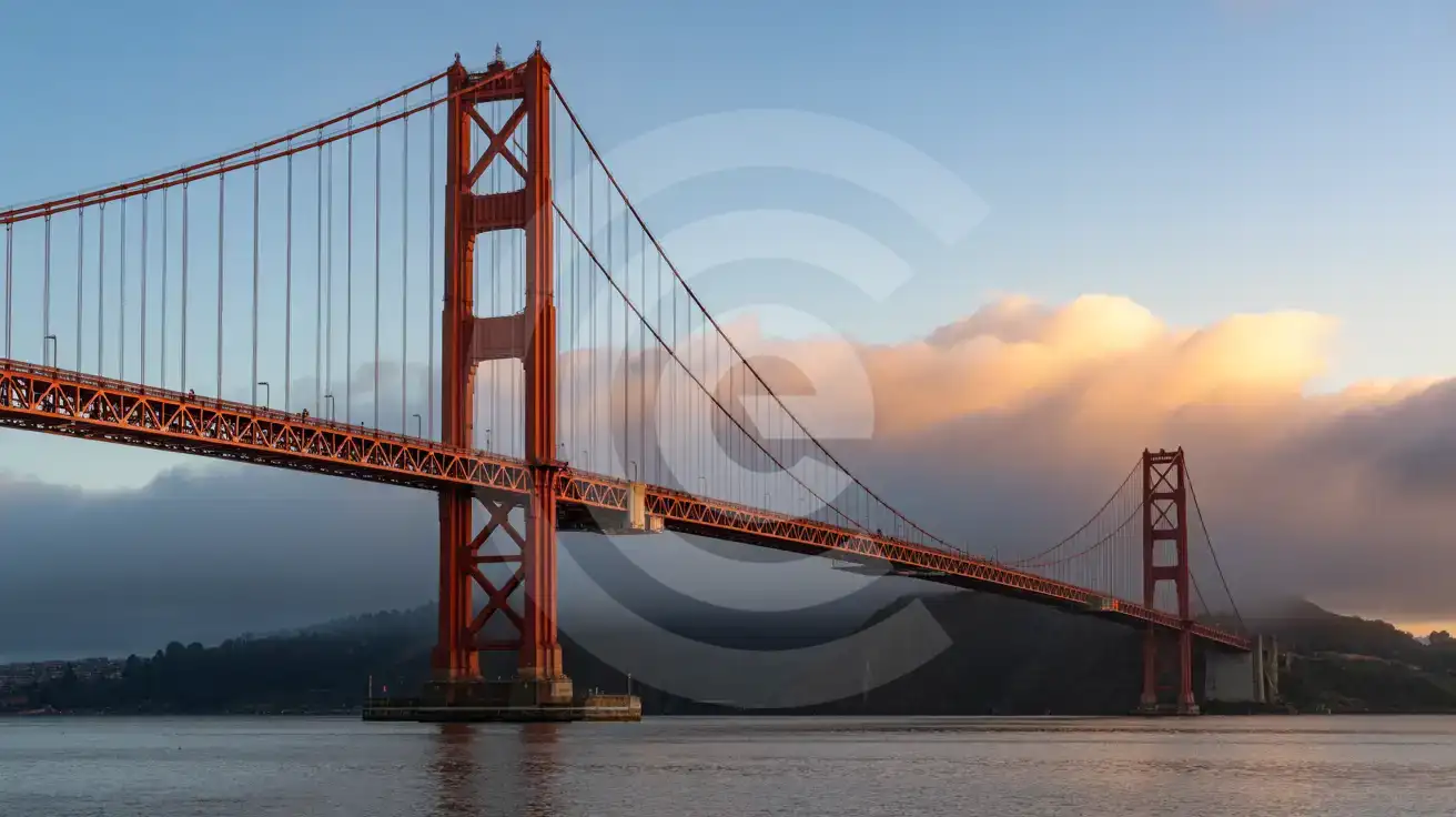
The Golden Gate at Dawn
Compare WiFi Options at Golden Gate Bridge
 Recommended Recommended | Local SIM / Operator | Roaming | |
|---|---|---|---|
| FEATURES | |||
| Setup time | Few minutes | Store visit + paperwork | Auto |
| No local ID needed | Online checkout | Local ID required | Use home account |
| Speed | 4G/LTE; 5G in some areas | Carrier-grade | Partner-dependent |
| Travel support | English support 24/7 | Operator shops and call centre | Home carrier hours |
| Keep home number | Dual SIM | Replaces it | Same number |
| Cost predictability | Fixed price | Bills can spike | Bill-shock risk |
| PRICING | |||
Typical pricing | See plans below | — | — |
PRICING — PICK YOUR ESIMNO PLAN
Featured eSIM plans
American Mobile

American Mobile
American Mobile
American Mobile
American Mobile
American Mobile


